Knowledge of the Maritime Domain
Real-time edge processing and delivery of improved optical detection integrated with radar and AIS receivers and sophisticated machine learning algorithms.
CO2 assessment and CO2 removal from ocean water
We work on how much CO2 absorbed by ocean waters and CO2 removing technology by electrochemical method by on board USV vessel and CO2 will be collected and stored.
CO2 to Ethanol & chemicals Production
The stored CO2 collected from USV fleet and use for ethanol production in our laboratory by electro catalytic reduction method
Biological parameters & Biomass & marine biota
Remote sensing and sensors will be used to gather data
Acoustics
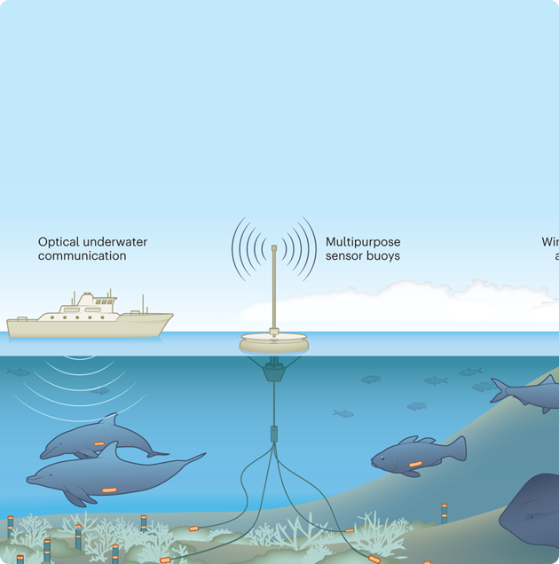
Fisheries use specialized acoustic devices to identify, categorize, and locate marine mammals, as well as echo sounders to quantify backscatter
Metocean
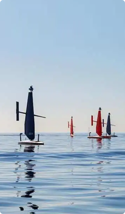
The newest science-grade sensors will be installed on our Unmanned Surface Voyager (USV) Voyager class of ships to gather vital ocean and climate data.
Bathymetry
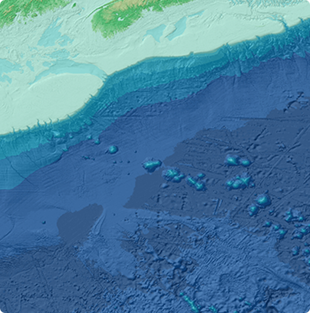
Complete ocean depth multibeam mapping up to 10,000 meters from the coast, satisfying the strictest data specifications.
NEAR-SHORE CARTOGRAPHY: The most advanced multibeam echo sounder technology will be used for for our feet class, which can satisfy even the most exacting customer needs for data collecting regarding seabed characterization, exploration, and navigation safety.
MAPS OF THE DEEP SEA: Push the envelope with the our Surveyor class, which can conduct extensive, full-ocean surveys down to 11,000 meters. IHO-compliant high-resolution mapping data will be produced by advanced multibeam sonar.
PRODUCT: Plankton Biomass Detection


PRODUCTS : Excellent Scientific Information from the Farthest Seas.
METOCEAN INFORMATION
DATA ON FISHERIES
PRODUCT : AN EARLYSILENT FISHERY SURVEY SOLUTION
CO2 TRACKING
CARBON SINK
CO2 REMOVAL FROM OCEAN
A two-step “electrochemical” process that draws CO2 out of the seawater
OUR PAYLOADS
CRITICAL DATA FOR WEATHER & CLIMATE
OUR PRODUCTS
HIGH-RESOLUTION DATA AT YOUR FINGERTIPS
PRODUCT: Interdisciplinary areas coastal & ocean research & gathering combined data, collection of data, processing and delivering solution.

Devansha Technologies LLC, the goal is to map, explore, and monitor the ocean sustainably in order to better understand, safeguard, and preserve the planet. Obtaining and delivering vital data for research institutions, governmental organizations, and business associates. Their state-of-the-art technologies and professionalism are much appreciated.
DEVANSH TECHNOLGIES LLC chooses an affordable technological solution by utilizing the power of renewable energy and autonomous technology, ocean data is being collected in a way that is redefining accessibility and benefiting hundreds of scientific works, research and development organizations, and commercial applications.
The remote environmental monitoring technologies are revolutionized by DEVANSHA TECHNOLOGIES LLC-FZ. Compared to typical survey vessels, these USVs are far less expensive to run and maintain, which lowers the entire cost of hydrographic surveying operations, saves millions of dollars, and results in net zero greenhouse gas emissions. Additionally, they are more environmentally friendly due to their lower carbon footprint, superior technology, and ability to solve numerous issues for the marine industry with a single solution.
Meydan Grandstand, 6th floor, Meydan Road, Nad Al Sheba, Dubai, U.A.E
+971 54 549 8565
info@devanshtechnolgies.com